
黄土高原典型流域水沙变化归因对比分析
2020-04-10 07:25蒋凯鑫于坤霞曹文洪张晓明
农业工程学报 2020年4期
蒋凯鑫,于坤霞,曹文洪,张晓明,李 鹏,孙 倩,刘 昱
黄土高原典型流域水沙变化归因对比分析
蒋凯鑫1,2,于坤霞1,2※,曹文洪3,张晓明3,李鹏1,2,孙倩1,2,刘昱1,2
(1. 西安理工大学省部共建西北旱区生态水利国家重点实验室,西安 710048;2. 西安理工大学旱区生态水文与灾害防治国家林业局重点实验室,西安 710048;3. 中国水利水电科学研究院泥沙所流域水循环模拟与调控国家重点实验室,北京 100048)
近几十年来,黄河中游黄土高原地区水沙变化显著。众多学者以该地区典型流域无定河开展了大量研究,但局限于方法的突破而忽视了方法间的对比分析。为此,该研究采用双累积曲线法、水文法、弹性系数法和水保法对无定河流域1957—2010年水沙变化进行归因对比分析。结果表明:无定河流域年降水量未发生显著变化,年潜在蒸散发、年径流量和年输沙量呈显著减少趋势且突变年份依次为1982、1971、1971年。径流归因对比分析表明,水文法与弹性系数法结果较为接近,水保法人类活动贡献率偏小;输沙归因对比分析表明,水保法与其他3种方法结果一致。归因分析表明,人类活动是流域水沙变化的主控因素且逐年增强,人类活动中对径流变化起主导作用的是灌溉引水和造林;对输沙变化起主导作用的是淤地坝和造林。淤地坝的淤满或失效对流域水保措施减水减沙效益影响较大。因此,未来无定河流域的治理应继续落实退耕还林还草政策,并加强淤地坝等工程措施的布局优化和后期维护。
径流;流域;输沙;黄土高原;无定河;归因对比分析
0 引 言
黄土高原是中国水土流失的重灾区,也是中国生态建设治理的重点区域[1-2]。近几十年来,气候变化、日益频繁发生的极端降雨事件[3]及愈加强烈的人类活动[4],使得黄土高原地区径流、输沙发生了显著变化[5]。黄土高原作为黄河流域的主要组成部分[6],贡献了入黄泥沙的近90%[7],自20世纪70年代以来治理后,减沙幅度最大的区域主要分布在该地区以无定河为中心的极强烈侵蚀区和汾河流域的大部分地区[8]。因此诸多学者以无定河流域为例开展水沙变化研究。张鑫等[9]应用重标度极差分析法对无定河流域分析发现赵石窑站和白家川站的径流量与输沙量具有继续下降的趋势,人类活动是引起这种变化的主要原因。Liang等[10]基于Budyko的弹性系数法和分解法量化了无定河流域径流对气候变化和人类活动的响应,结果表明径流变异性对人类活动最敏感,人类活动贡献率为65%。孙倩等[11]对黄河中游多沙粗沙区典型流域径流与输沙量分析表明,径流量和输沙量均有显著减少趋势,人类活动对无定河流域径流减少、输沙减少的贡献率分别为75.5%、79.8%。Han等[12]通过收集无定河流域水文气象数据,将其划分为5个时期,结果表明,水保措施对降雨-径流-输沙关系的变化起着重要的作用,且不同时期具体发挥作用的水保措施存在差异。
既有研究的水文要素资料序列及来源站点不一致等造成划分时段不同、分析结果存在差异。同时关于方法间计算结果对比及各种方法适用性的研究较少。为此本研究统一划分时期,采用不同的贡献率计算方法,分析对比不同影响因素对流域径流输沙变化的贡献率,讨论不同贡献率计算方法的适用性,以期为黄河中游黄土高原地区急剧变化的水沙关系提供一定的理论支持。
1 材料与方法
1.1 研究区概况
无定河是黄河中游一级支流,是陕北榆林地区最大的河流[13]。无定河发源于陕北定边、吴起、靖边三县交界的白于山北麓,流经靖边、横山、米脂、绥德、清涧,最终汇入黄河。无定河流域干流全长491.1 km,总面积30 261 km2,河道平均比降1.97‰,把口站白家川水文站集水面积为29 662 km2,占流域面积的98.02%。由于流域内恶劣的自然条件和人类活动,其土壤侵蚀速率是黄土高原地区最高的[14]。无定河流域位置见图1。
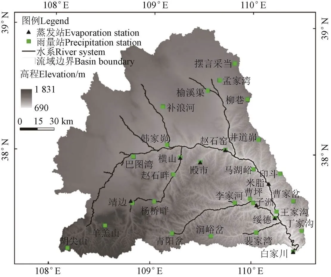
图1 无定河流域位置图
1.2 数据来源
1957—2010年白家川水文站年径流量、年输沙量及流域内雨量站的点年降水量资料均来自于《黄河流域水文年鉴》。无定河流域面降水量通过泰森多边形法求得。流域年潜在蒸发数据来自于陕西省水文局。流域梯田、造林、种草、坝地及封禁治理等面积来自《榆林市水土保持统计年鉴》。
1.3 研究方法
1.3.1 趋势分析
本研究采用Mann-Kendall趋势检验、线性趋势检验、滑动平均法及Pettitt突变点检验对无定河流域1957—2010年的年降水量、年潜在蒸发量、年径流量及年输沙量进行趋势分析和突变点检验。
1.3.2 归因分析
1)双累积曲线法
双累积曲线法是将突变年份前的时段作为研究流域的基准期,即认为此时段人类活动可忽略;突变年份之后作为研究期,即认为此时段流域的径流、输沙受到了气候变化和人类活动的共同作用。将研究期降雨数据代入基准期建立的降雨-径流、降雨-输沙关系,进而获得研究期无人类活动下的径流、输沙模拟值,其与研究期径流、输沙实测值的差值作为人类活动对水沙变化的影响。
2)水文法
水文法是通过对流域基准期的降雨-径流、降雨-输沙关系进行回归分析优选,参数率定,模型确定,然后计算出流域大规模开展水土流失治理时期的径流输沙模拟值,扣除实测值,获得流域水利水保措施的减水减沙效益。无定河流域常见水文法模型[15-18]见表 1所示。
为了优选出相对最佳的模型,本研究选取纳什效率系数(nash-sutcliffe efficiency,NSE)和相对误差(relative error,RE)作为评价指标进行模型评价。

表1 无定河常见水文法模型
注:指径流模拟值;指输沙模拟值;P指年降水量;P指汛期(6—9月)降雨量;7+8指7—8月降雨量;6+9指6月和9月降雨量;、、为模型参数;下同。
Note:refers to simulated value of runoff;refers to simulated value of sediment transport; Prefers to the annual precipitation; Prefers to precipitation during flood season;7+8refers to precipitation from July to August;6+9refers to precipitation in June and September;,andrefer to the model parameters; the same below.
3)弹性系数法
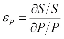
弹性系数定义为因变量变化率与自变量变化率的比值,它被认为是径流对其他变量(如降水、潜在蒸散发)敏感性的有效指标[19]。假设研究流域地形和土壤在研究时段内不发生变化,则在长时段内,径流(或输沙)的变化量可表示为:
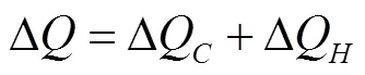
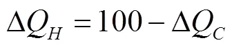
式中D表示径流(或输沙)的总变化量;DQ和DQ分别表示气候变化和人类活动导致的径流(或输沙)变化量。
气候变化对径流(或输沙)变化量的影响量为:

式中和分别为年降水量和年潜在蒸散发量对年径流量的弹性系数;D和D0分别为降水和潜在蒸散发的变化。
① 计算径流贡献率的弹性系数
本研究径流贡献率的降水弹性系数采用Sankarasubramanian等[20]通过实测水文气象序列得到的。()函数采用Zhang等[21]的公式。
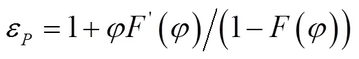


式中表示干燥系数,即年潜在蒸散发与年降水的比值;表示一个地区植被覆被条件的参数,本研究通过绘制0/&/相关图,与Zhang等[21]绘制的0/&/图进行比较,求得=2.0。
② 计算输沙贡献率的弹性系数
为了消除流域面积对径流和输沙关系的影响,本研究对流域径流、输沙均除以流域面积,即拟合径流深和输沙模数的关系:

输沙公式推导具体如下:

4)水保法
本研究采用的水保法为指标法,即核实流域内各水利水保措施面积等,确定不同地貌类型区不同条件、时期下各措施减水减沙指标,分项计算,逐项累加,得到流域水利水保措施的减水减沙量。参考水利部第一期黄河水沙变化基金项目研究成果[18,22-24],确定流域各项水利水保措施减水减沙指标,见表2。采用无定河流域2011年水利普查的骨干坝数据、2009年淤地坝安全大检查数据等[25]分析计算无定河流域截至2010年底流域内淤地坝实际拦沙总量,按不同年份淤地坝控制面积、产沙降雨指标权系数分配的方法,反推不同时期淤地坝拦沙量。流域灌溉定额参考《陕西省水资源利用》取5 940 m3/hm2,灌溉水回归系数取15%,灌溉引水平均含沙量据调查取10 kg/m3。

表2 无定河流域水保措施减水减沙效益
2 结果与分析
2.1 趋势与变点分析
对无定河流域年降水量、年潜在蒸散发、年径流量和年输沙量进行趋势分析,见图2。结果表明无定河流域的年降水量(图2a)变化趋缓,其5a滑动平均值在系列均值附近波动;而流域年潜在蒸散发(图2b)、年径流量(图2c)和年输沙量(图2d)均呈明显减少趋势。
本研究进一步采用M-K检验、Pettitt检验分别进行系列一致性分析和突变分析,结果见表3。结果表明:年降水量呈不显著增加趋势,年潜在蒸散发、年径流量及年输沙量均呈极显著减少趋势;年潜在蒸散发突变年份为1982年,年径流量和年输沙量的突变年份均为1971年。上述分析结果与牟夏等[26]、任宗萍等[27]分析结果一致。
2.2 水文法模型优选
不同水文法模型拟合结果见表4。径流方面,除模型1以外的3个水文法模型纳什效率系数NSE和相对误差RE基本一致;输沙方面,模型1、2、3的NSE和RE基本一致,而模型4表现相对较好。综合来看,模型4的NSE更接近于1且RE更小,即模拟效果相对更好,故本研究采用模型4代表水文法对无定河流域水沙变化进行归因分析。

图2 无定河流域水文要素年际变化曲线
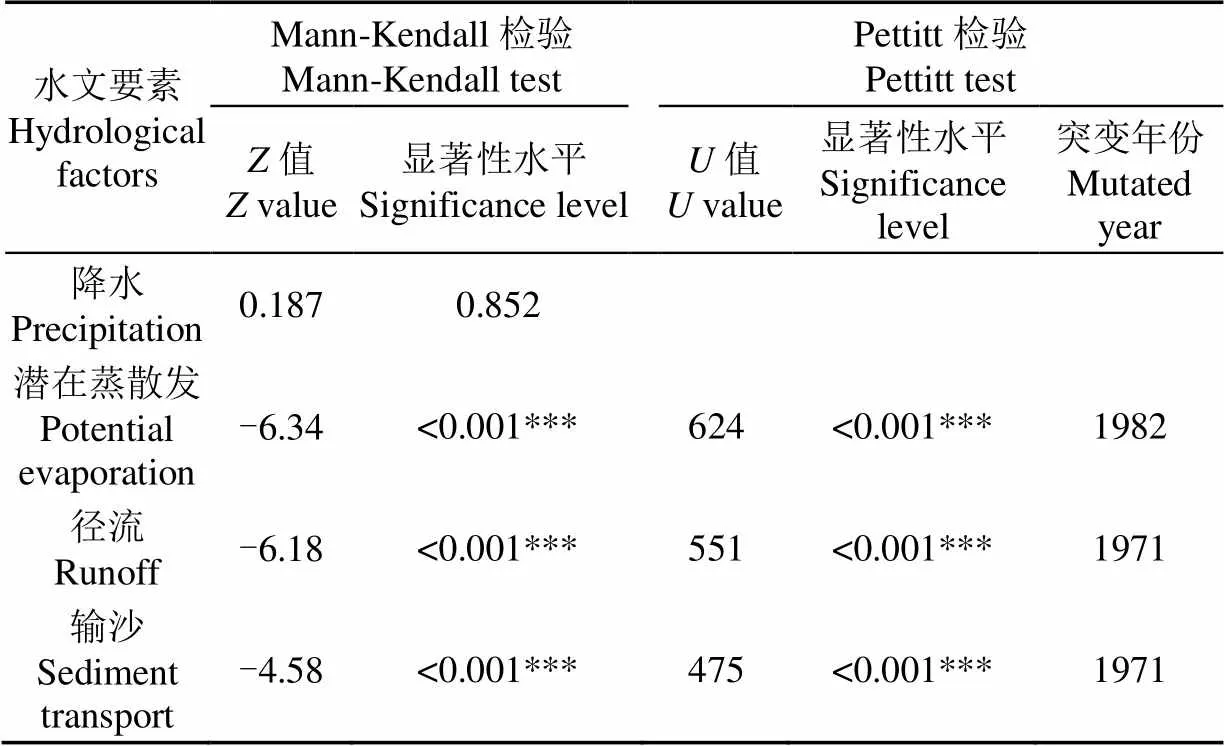
表3 无定河流域水文要素M-K检验与Pettitt检验计算结果
注:、分别表示M-K检验、Pettitt检验统计量;***为99.9%置信水平。
Note:andvalue represent Mann-Kendall test and Pettitt test statistics respectively. *** is 99.9% confidence level.

表4 无定河水文法模型参数率定及优选
2.3 归因对比分析
在无定河流域内,分别采用弹性系数法、双累积曲线法、水文法和水保法计算气候变化和人类活动对流域径流输沙变化的贡献率,其中基准期为1957—1971年。结果见表5。总体来看,在无定河流域,人类活动为径流输沙变化的主导因素,其对输沙减少的作用较对径流减少的作用大。人类活动中灌溉引水和造林对流域径流变化起主导作用;淤地坝和造林对流域输沙变化起主导作用。淤地坝对流域径流减少的效益较小,但对流域输沙量的减少占据了主导作用,贡献率达43.3%。
径流方面,双累积曲线法、水文法、弹性系数法的计算结果较为一致,水保法对人类活动的计算结果相对偏小;输沙方面,4种方法的结果均表现出人类活动占据主导作用,具体为双累积曲线法与弹性系数法的计算结果较为一致,水文法和水保法的计算结果较为一致。

表5 无定河流域年径流输沙变化归因分析
进一步对无定河流域内各时期气候变化和人类活动对水沙变化的影响进行分析,见图3。人类活动对流域径流、输沙变化的贡献率(图3b、图3d)明显较气候变化对径流、输沙变化的贡献率(图3a、图3c)大,且总体来看人类活动对径流、输沙变化的贡献率呈增加的趋势。人类活动对径流、输沙的贡献率在1990年左右出现一低谷,同时该低谷对径流的影响(图3b)较对输沙的影响(图3d)大,即与对输沙的影响相比,人类活动对径流的影响进一步减弱。

图3 无定河流域水沙变化不同方法对比分析
3 讨 论
本研究双累积曲线法仅考虑年降水量单一自变量,并将其与径流输沙间的关系概化为线性,这在水保措施少、治理标准低、大雨产大沙特征明显的基准期有较好的适用性[28],但并未考虑黄土高原场次降雨中产流产沙的侵蚀性降雨[29]、降雨年内分布与基准相比发生的变化[30]及坡面、沟道治理措施的持续开展和减水减沙作用的滞后显现,即存在年降水量之外的因素对径流、输沙产生着不可忽视的作用,或造成计算结果中人类活动对水沙变化的贡献率计算偏小。为提高突变后研究期模拟值的准确发生,一种是在降雨-径流、降雨-输沙关系中引入一个反映年内降雨分配的参数,使关系式的物理意义更加清晰,如本研究中采用的水文法;另一种是从流域内长时段水量平衡原理出发,考虑各水沙变化潜在影响因素并计算相关贡献率,如本研究中采用的弹性系数法。在降雨-径流归因分析结果中,见表5,可发现水文法和弹性系数法的结果基本一致,与双累积曲线法相比结果更为合理。水保法尚无法考虑影响流域径流输沙变化的所有因素,如不同措施之间的耦合作用、淤地坝淤积比及其异地减沙作用、流域内极端事件(干旱或暴雨)对水利水保措施的影响、流域内社会经济发展带来的道路建设及取用河沙等。
人类活动对径流、输沙贡献率在1990年左右出现低谷的原因在于流域内20世纪70、80年代修建完成的大部分中小型淤地坝因拦蓄寿命多小于20 a,至1990年左右时已淤满或已失效[31],而退耕还林还草政策、淤地坝作为之一的水利部“亮点”工程等尚未出台实施。而低谷对径流影响较输沙大的原因在于淤地坝淤满之后虽失去了拦蓄泥沙的库容,但因拦蓄泥沙而抬高的坝地有效增大了沟道过水断面,使携带的泥沙沿程沉降,而径流则可以越过淤满的坝顶进入河道。流域内输沙减少幅度较径流的大,水利水保措施对下垫面的改变有效减缓或阻止了产汇流的形成,而下渗的径流又促进了林草措施进一步发挥作用。
4 结 论
本研究选取黄河中游黄土高原地区典型流域无定河流域,以其年降水量、年潜在蒸散发、年输沙量和年径流量及水利水保措施为研究对象,通过趋势突变分析和归因对比分析,得出不同方法下气候变化和人类活动对径流输沙的贡献率,结果表明:
1)通过M-K检验和Pettitt检验得出,无定河流域1957—2010年年降水量呈不显著增加趋势;年径流量和年输沙量呈显著减少趋势,其突变年份均为1971年。
2)不同方法分析结果表明,径流方面,水文法和弹性系数法物理意义较双累积曲线法更为清晰,三者计算结果较水保法更为合理;输沙方面,4种方法分析结果均为人类活动占据主导作用,区别在于对人类活动的水沙变化贡献率具体大小方面,即水保法和水文法结果较为一致,弹性系数法和双累积曲线法结果较为一致。
3)不同径流输沙影响因素贡献率计算方法的结果表明,人类活动占据主导作用且其作用逐渐增强。水利水保措施对输沙变化的作用较对径流变化的强。人类活动中,径流方面,灌溉引水是一项重要因素;输沙方面,淤地坝是短期内减少流域输沙的有效措施,而20世纪集中修建的淤地坝的淤满或失效在短期内将会削弱水利水保措施的减水减沙效益。长远来看,流域内持续开展的退耕还林还草等生态建设对径流、输沙的影响将逐渐发挥主导作用。
[1]刘国彬,上官周平,姚文艺,等. 黄土高原生态工程的生态成效[J]. 中国科学院院刊,2017,32(1):11-19. Liu Guobin, Shangguan Zhouping, Yao Wenyi, et al. Ecological effects of soil conservation in Loess Plateau[J]. Bulletin of Chinese Academy of Sciences, 2017, 32(1): 11-19. (in Chinese with English abstract)
[2]Wang F, Mu X, Li R, et al. Co-evolution of soil and water conservation policy and human–environment linkages in the Yellow River Basin since 1949[J]. Science of The Total Environment, 2015, 508: 166-177.
[3]Zhao Y, Cao W, Hu C, et al. Analysis of changes in characteristics of flood and sediment yield in typical basins of the Yellow River under extreme rainfall events[J]. Catena, 2019, 177: 31-40.
[4]Kong D, Miao C, Wu J, et al. Impact assessment of climate change and human activities on net runoff in the Yellow River Basin from 1951 to 2012[J]. Ecological Engineering, 2016, 91: 566-573.
[5]Zheng H, Miao C, Wu J, et al. Temporal and spatial variations in water discharge and sediment load on the Loess Plateau, China: A high-density study[J]. Science of the Total Environment, 2019, 666: 875-886.
[6]高海东,李占斌,李鹏,等. 基于土壤侵蚀控制度的黄土高原水土流失治理潜力研究[J]. 地理学报,2015,70(9):1503-1515. Gao Haidong, Li Zhanbin, Li Peng, et al. The capacity of soil loss control in the Loess Plateau based on soil erosion control degree[J]. Acta Geographica Sinica, 2015, 70(9): 1503-1515. (in Chinese with English abstract)
[7]Wang S, Fu B, Piao S, et al. Reduced sediment transport in the Yellow River due to anthropogenic changes[J]. Nature Geoscience, 2015, 9: 38-41.
[8]王万忠,焦菊英. 黄土高原侵蚀产沙强度的时空变化特征[J]. 地理学报,2002,57(2):210-217. Wang Wanzhong, Jiao Juying. Temporal and spatial variation characteristics of erosion and sediment yield in the Loess Plateau[J]. Acta Geographica Sinica, 2002, 57(2): 210-217. (in Chinese with English abstract)
[9]张鑫,蔡焕杰,尹晓楠. 应用重标度极差分析法(R/S)分析无定河流域水沙变化[J]. 农业工程学报,2010,26(增刊2):212-217. Zhang Xin, Cai Huanjie, Yin Xiaonan. Variation trends analysis of runoff and sediment time series based on R/S method in Wuding River Basin[J]. Transactions of the Chinese Society of Agricultural Engineering (Transactions of the CSAE), 2010, 26(Supp.2): 212-217. (in Chinese with English abstract)
[10]Liang W, Bai D, Jin Z, et al. A study on the streamflow change and its relationship with climate change and ecological restoration measures in a sediment concentrated region in the Loess Plateau, China[J]. Water Resources Management, 2015, 29(11): 4045-4060.
[11]孙倩,于坤霞,李占斌,等. 黄河中游多沙粗沙区水沙变化趋势及其主控因素的贡献率[J]. 地理学报,2018,73(5):945-956. Sun Qian, Yu Kunxia, Li Zhanbin, et al. The trends of streamflow and sediment and their driving factors in the middle reaches of the Yellow River[J]. Acta Geographica Sinica, 2018, 73(5): 945-956. (in Chinese with English abstract)
[12]Han J, Gao J, Luo H. Changes and implications of the relationship between rainfall, runoff and sediment load in the Wuding River basin on the Chinese Loess Plateau[J]. Catena, 2019, 175: 228-235.
[13]陈思. VIC大尺度陆面水文模型在无定河流域的应用研究[D]. 北京:中国地质大学(北京),2018. Chen Si. The Application of Variable Infiltration Capacity (VIC) Macroscale Hydrologic Model in Wuding River Basin[D]. Beijing: China University of Geosciences(Beijing), 2018. (in Chinese with English abstract)
[14]Shi C, Zhou Y, Fan X, et al. A study on the annual runoff change and its relationship with water and soil conservation practices and climate change in the middle Yellow River basin[J]. Catena, 2013, 100: 31-41.
[15]贾绍凤,梁季阳. 黄土高原降雨、径流、产沙相互关系的研究[J]. 水土保持学报,1992(3):42-47. Jia Shaofeng, Liang Jiyang. The correlation among rainfall, runoff and sediment generation in the Loess Plateau[J]. Journal of Soil and Water Conservation, 1992(3): 42-47. (in Chinese with English abstract)
[16]Li L, Zhang L, Wang H, et al. Assessing the impact of climate variability and human activities on streamflow from the Wuding River basin in China[J]. Hydrological Processes, 2007, 21: 3485-3491.
[17]汤立群,陈国祥. 水土保持减水减沙效益计算方法研究[J]. 河海大学学报:自然科学版,1999(1):82-87. Tang Liqun, Chen Guoxiang. Study on calculation method of water and soil conservation water and sediment reduction benefit[J]. Journal of Hohai University(Natural Sciences), 1999(1): 82-87. (in Chinese with English abstract)
[18]张经济,冀文慧,冯晓东. 无定河流域水沙变化现状、成因及发展趋势的研究[M]//汪岗,范昭. 黄河水沙变化研究(第二卷). 郑州:黄河水利出版社,2002. 393-429.
[19]Li Y Z, Liu C M, Zhang D, et al. Reduced runoff due to anthropogenic intervention in the Loess Plateau, China[J]. Water, 2016, 8(458): 1-16.
[20]Sankarasubramanian A, Vogel R M. Hydroclimatology of the continental United States[J]. Geophysical Research Letters, 2003, 30(7):314-326.
[21]Zhang L, Dawes W R, Walker G R. Response of mean annual evapotranspiration to vegetation changes at catchment scale[J]. Water Resources Research, 2001, 37(3): 701-708.
[22]惠养瑜,冀文慧,同信奇,等. 无定河流域水沙变化及其发展趋势预测研究[M]//汪岗,范昭. 黄河水沙变化研究(第一卷:下册). 郑州:黄河水利出版社,2002. 689-714.
[23]左仲国. 清水河流域水沙变化及发展趋势预测[M]//汪岗,范昭. 黄河水沙变化研究(第一卷:上册). 郑州:黄河水利出版社,2002. 439-448.
[24]冉大川,张栋,焦鹏,等. 西柳沟流域近期水沙变化归因分析[J]. 干旱区资源与环境,2016,30(5):143-149. Ran Dachuan, Zhang Dong, Jiao Peng, et al. Analysis on the attribution of water and sediment changes in Xiliugou basin[J]. Journal of Arid Land Resources and Environment, 2016, 30(5): 143-149. (in Chinese with English abstract)
[25]韩向楠,谢世友,高云飞. 近年无定河流域淤地坝拦沙作用研究[J]. 人民黄河,2018,40(11):9-12,41. Han Xiangnan, Xie Shiyou, Gao Yunfei. Study on sediment retaining effect of check dams in Wuding River Basin in recent years[J]. Yellow River, 2018, 40(11): 9-12, 41. (in Chinese with English abstract)
[26]牟夏,刘强,平凡,等. 1960—2007年无定河流域径流情势变化及其归因分析[J]. 北京师范大学学报:自然科学版,2017,53(4):465-471. Mou Xia, Liu Qiang, Ping Fan, et al. Analysis of changes in annual streamflow and its influence factors in Wuding River basin in the last 50 years (1960—2007)[J]. Journal of Beijing Normal University(Natural Sciences), 2017, 53(4): 465-471. (in Chinese with English abstract)
[27]任宗萍,马勇勇,王友胜,等. 生态建设条件下无定河不同地貌区径流变化归因分析[J]. 生态学报,2019,39(7):1-9. Ren Zongping, Ma Yongyong, Wang Yousheng, et al. Runoff changes and attribution analysis in tributaries of different geomorphic regions in Wuding River under ecological construction[J]. Acta Ecologica Sinica, 2019, 39(7): 1-9. (in Chinese with English abstract)
[28]李勉,李平,杨二,等. 黄土丘陵区淤地坝建设后小流域泥沙拦蓄与输移特征[J]. 农业工程学报,2017,33(18):80-86. Li Mian, Li Ping, Yang Er, et al. Characteristics of sediment retention and transport in small watershed after construction of check dams in Loess Hilly Area[J]. Transactions of the Chinese Society of Agricultural Engineering (Transactions of the CSAE), 2017, 33(18): 80-86. (in Chinese with English abstract)
[29]张攀,姚文艺,唐洪武,等. 黄土坡面细沟形态变化及对侵蚀产沙过程的影响[J]. 农业工程学报,2018,34(5):114-119. Zhang Pan, Yao Wenyi, Tang Hongwu, et al. Rill morphology change and its effect on erosion and sediment yield on loess slope[J]. Transactions of the Chinese Society of Agricultural Engineering (Transactions of the CSAE), 2018, 34(5): 114-119. (in Chinese with English abstract)
[30]Tang X, Miao C, Xi Y, et al. Analysis of precipitation characteristics on the loess plateau between 1965 and 2014, based on high-density gauge observations[J]. Atmospheric Research, 2018, 213: 264-274.
[31]高云飞,郭玉涛,刘晓燕,等. 陕北黄河中游淤地坝拦沙功能失效的判断标准[J]. 地理学报,2014,69(1):73-79. Gao Yunfei, Guo Yutao, Liu Xiaoyan, et al. Failure criteria of the warping dams on sediment interception in the Middle Yellow River in northern Shaanxi[J]. Acta Geographica Sinica, 2014, 69(1): 73-79. (in Chinese with English abstract)
Attributional comparative analysis of runoff and sediment change in typical basin of Loess Plateau
Jiang Kaixin1,2, Yu Kunxia1,2※, Cao Wenhong3, Zhang Xiaoming3, Li Peng1,2, Sun Qian1,2, Liu Yu1,2
(1.-,,710048,; 2.,,710048,; 3.,,100048,)
In recent decades, the runoff and sediment of the Yellow River middle reaches located in the Loess Plateau have changed significantly. Many scholars have carried out a lot of researches on the Wuding River, a typical basin of the Loess Plateau, but these researches are focused on the breakthrough of methods and ignore the comparative analysis among methods. This study compared the difference of four methods, i.e., double cumulative curve method, hydrological method, elastic coefficient method and soil and water conservation method, to conduct attributional comparative analysis of runoff and sediment change in the Wuding River Basin from 1957 to 2010. Both double cumulative curve method and hydrological method separate the influence of climate change and human activity by substituting the precipitation data in the research period into the precipitation-runoff and precipitation-sediment transport relationships established in the reference period, and the hydrological method takes into account the annual distribution of precipitation. The elastic coefficient method generates runoff and sediment elasticities to quantify the effects of climate change and human activities. The soil and water conservation method refers to determining the runoff and sediment reduction indicators of each measure under different conditions and periods in different geomorphic areas. The results of trend and change point analysis showed that the annual precipitation in the Wuding River Basin has not changed significantly. The annual potential evaporation, annual runoff and annual sediment transport decreased significantly and the year of change point was 1982, 1971 and 1971, respectively. The attributional comparative analysis of runoff showed that the results of hydrological method were close to those of elastic coefficient method, and the contribution rate of human activities of soil and water conservation method was relatively small, and the attributional comparative analysis of sediment transport showed that the results of soil and water conservation method were consistent with those of the other three methods. Attribution analysis results indicated human activities were the dominant factor of runoff and sediment change in the basin, and their effects on runoff and sediment change were increasing year by year. Among different human activities, irrigation water diversion and afforestation played a leading role in runoff change, and check dam and afforestation played a leading role in sediment transport change. The full up or failure of check dam built in the 1970s and 1980s would largely weaken the runoff and sediment reduction benefits of water conservancy and soil conservation measures in the short term. In the long term, the impact of ecological construction, such as returning cultivated land to forestland or grassland, on runoff and sediment transport will gradually play a major role. Therefore, in the future, the governance of the Wuding River Basin should continue to implement the policy of conversion of cropland to forest and grassland, and strengthen the layout optimization and post-maintenance of engineering measures such as check dam.
runoff; watershed; sediment transport; Loess Plateau; Wuding River basin; attributional comparative analysis
蒋凯鑫,于坤霞,曹文洪,张晓明,李鹏,孙倩,刘昱. 黄土高原典型流域水沙变化归因对比分析[J]. 农业工程学报,2020,36(4):143-149. doi:10.11975/j.issn.1002-6819.2020.04.017 http://www.tcsae.org
Jiang Kaixin, Yu Kunxia, Cao Wenhong, Zhang Xiaoming, Li Peng, Sun Qian, Liu Yu. Attributional comparative analysis of runoff and sediment change in typical basin of Loess Plateau[J]. Transactions of the Chinese Society of Agricultural Engineering (Transactions of the CSAE), 2020, 36(4): 143-149. (in Chinese with English abstract) doi:10.11975/j.issn.1002-6819.2020.04.017 http://www.tcsae.org
2019-07-08
2019-10-16
国家自然科学基金面上项目(51879281,41877077);国家重点研发计划(2016YFC0402407)
蒋凯鑫,博士生,主要从事流域侵蚀动力学研究。Email:jiangkaizn@qq.com
于坤霞,博士,副教授,主要从事水文水资源研究。Email:yukunxia@126.com
10.11975/j.issn.1002-6819.2020.04.017
S157.1
A
1002-6819(2020)-04-0143-07
猜你喜欢
水利水电快报(2022年8期)2022-11-23
农业工程学报(2022年10期)2022-08-22
黑龙江大学自然科学学报(2022年1期)2022-03-29
现代农村科技(2021年9期)2021-12-06
山西水土保持科技(2021年4期)2021-12-05
农业科技与信息(2020年15期)2020-12-18
魅力中国(2020年39期)2020-12-08
品牌研究(2020年32期)2020-08-09
人民珠江(2019年4期)2019-04-20
爱你(2018年22期)2018-11-14
